
- An 84 mile trail that follows the Weiser River, extending from Weiser to Rubicon.
- Enjoy the trail by foot, bike, horseback, or cross-country skis.
- The northern end of the trail is just 17 miles northwest of McCall, in Rubicon.
- View a variety of splendid wildlife along the way.
Overview
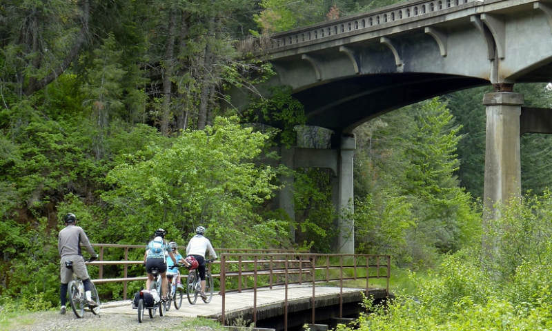
Winding through rolling hills, verdant forest, and the open plains of west central Idaho is the scenic 84 mile Weiser River Trail. It is the longest continuous trail in the state and follows the sparkling waters of the Weiser River. The rail trail starts in the sagebrush dotted semi-arid desert of Weiser and ends in the tiny forested town of Rubicon, not far from McCall. The trail is accessible year round and is perfect for hikers, horseback riders, bikers, and Nordic skiers. Take a few days to travel the trail by camping or staying at a hotel along the way.
Location & Information
The trail is located in west central Idaho and follows the Weiser River from Weiser to Rubicon. Rubicon is about 17 miles northwest of McCall.
Contact: Friends of the Weiser River Trail, 3494 Rush Creek Road, Cambridge, ID 83610. Phone: 1-888-698-7245. Visit their website here.
Activities
Wildlife viewing is a favorite activity of those who travel the trail. The trail takes you through the natural habitat of elk, deer, and bear as well as a variety of birds including wild turkeys, heron, hawks, eagles, and water fowl.
You can explore the trail by foot, horseback, bike, or skis. Commercial campgrounds are available along the way if you want to camp out and enjoy the beautiful scenery and fresh air while you explore this stretch of western Idaho.
Fun Facts
- This recreational rail trail was converted from the former Pacific and Idaho Northern railroad.
- The elevation gains and losses along the trail total 3000 feet.
- The trail surface varies and is comprised of asphalt, ballast, and gravel.
- The trail passes through Adams and Washington counties in western Idaho.

